The U.S. Department of Agriculture is preparing to test satellite imagery, artificial intelligence and machine learning as part of a new effort to improve the accuracy of American crop estimates. Agriculture Secretary Brooke Rollins announced the initiative on September 1, 2026, at the Farm Progress Show in Boone, Iowa, as the agency responds to growing criticism over the reliability of agricultural data.
The proposed pilot would bring together USDA, NASA and other federal agencies to modernize how acreage and yield information is collected, processed and verified. The move comes after a difficult period for agricultural statistics, with farmers and market participants questioning some USDA estimates and the way those numbers can influence grain prices, farm income and production decisions. Reuters reported that the agency’s new approach is intended to improve data collection while rebuilding confidence among producers.
The timing is significant. USDA crop estimates are more than statistical reports. They influence commodity markets, crop insurance calculations, farm lending decisions, transportation planning and decisions about when producers sell their crops. A change in how those estimates are generated could therefore affect the entire agricultural supply chain.
USDA Wants More Technology Behind Crop Estimates
For decades, USDA’s National Agricultural Statistics Service has relied heavily on producer surveys, field observations, administrative records and statistical models to estimate crop acreage and production. Those methods remain central to the system, but the department now wants technology to provide additional layers of information.
Rollins’ September 1 announcement points toward a system in which satellite imagery and machine-learning tools could help USDA identify planted acreage, monitor crop development and improve yield estimates. NASA and other federal agencies are expected to participate in the modernization effort.
The proposal does not mean USDA is abandoning farmers’ reports. In fact, producer information remains one of the most important components of the existing system. NASS says its Agricultural Yield Survey collects farmer-reported acreage and expected yields during the growing season, with monthly updates providing information about changing crop conditions. The survey operates from May through November and can involve thousands of producers depending on the month.
The more likely direction is a hybrid model in which farmer reports, satellite observations, administrative records and statistical models reinforce one another.
That distinction matters because technology can provide coverage that individual surveys cannot. A satellite can observe millions of acres repeatedly, while a field survey depends on a representative sample of farms and the availability of accurate producer responses.
Why USDA Crop Data Matters To Agricultural Markets
The stakes are unusually high because USDA estimates can move markets long before harvest is complete.
A change in expected corn or soybean production can alter futures prices, basis levels, storage decisions and export expectations. Producers use the information when deciding whether to sell immediately, store grain or adjust marketing strategies. Lenders, insurers, processors and exporters use the same estimates for their own planning.
USDA’s own methodology documentation describes agricultural statistics as inputs for producers, financial institutions, insurance companies, agribusinesses, policymakers and commodity buyers. The information is also used in federal programs involving acreage, production potential, conservation and trade. (USDA Crop Production Methodology)
That makes accuracy particularly important during years when weather conditions are uneven across major production regions.
The 2026 growing season has already demonstrated the challenge. USDA’s August crop data showed 61% of U.S. corn rated good to excellent and 63% of soybeans in those categories as of August 2. Those conditions represented a significant decline from the previous year and reflected the effects of heat, dryness and uneven growing conditions across parts of the country.
At the same time, USDA’s August production forecast projected approximately 16.01 billion bushels of corn production from 88.59 million harvested acres, alongside roughly 4.52 billion bushels of soybeans from 85.78 million harvested acres. Small changes in yield assumptions can therefore translate into enormous changes in the national supply balance.
The Existing System Already Uses Multiple Data Sources
The current USDA system is more sophisticated than a simple farmer survey.
NASS uses a combination of list-frame and area-frame sampling to represent agricultural operations across the country. The area frame covers land geographically, while the list frame contains known farms and agricultural operations. USDA also incorporates administrative information from other agencies into certain estimates.
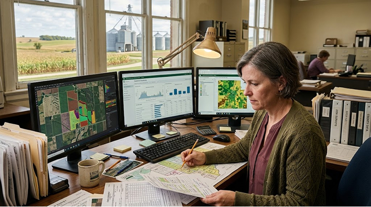
For county-level crop estimates, NASS combines producer reports with acreage information from the Farm Service Agency and Risk Management Agency, along with soil productivity information and statistical methods. The agency recently emphasized that producer participation remains essential even as additional data sources become available. (USDA County Crop Estimates)
This existing structure gives USDA an important advantage as it experiments with satellite technology. The department is not starting with an empty database. It already has decades of historical observations against which new satellite and AI-based estimates can be compared.
That historical record could be one of the most valuable components of the modernization effort.
Satellites Could Provide A Much Larger View
Satellite imagery offers something traditional agricultural surveys cannot easily provide: repeated observation across enormous geographic areas.
Instead of relying entirely on information from sampled farms, satellite systems can observe changes in vegetation across entire regions. Different wavelengths of light can help distinguish vegetation, bare soil and other land characteristics. Repeated images can also show changes in crop development over time.
For USDA, the potential application is particularly significant in acreage estimation.
If machine-learning systems can accurately distinguish corn from soybeans, wheat, cotton and other crops across large areas, USDA could gain an independent measurement that can be compared against producer reports and administrative data.
That would not automatically make satellite estimates correct. Clouds, mixed cropping systems, field boundaries, irrigation differences, crop maturity and unusual weather can complicate image interpretation. But the technology could provide another independent signal against which survey results can be tested.
The potential value is therefore less about replacing human information and more about creating another verification layer.
AI Could Help Process Agricultural Data Faster
The other major component of the USDA initiative is artificial intelligence.
Satellite imagery creates enormous quantities of information. Processing that information manually would be impractical, especially if USDA wants frequent observations across millions of agricultural acres.
Machine-learning systems could be trained to recognize patterns in vegetation, crop development and field characteristics. Over time, those systems could compare current imagery with historical crop behavior and other datasets to identify anomalies.
AI could also help USDA process information submitted by producers and identify inconsistent or unusual observations for additional review.
That could become especially valuable during years of extreme weather.
A drought affecting Nebraska, Iowa and parts of Illinois may produce very different crop responses from a drought affecting Texas or the Southern Plains. Similarly, excessive rainfall in one region can coexist with severe moisture deficits elsewhere.
A technology system capable of analyzing large volumes of spatial data could potentially identify those differences faster than a traditional reporting structure alone.
The USDA’s current modernization effort also includes improving how farmers provide information, including online polling and pre-filled data fields, according to Reuters. The goal is to reduce unnecessary reporting while allowing producers to focus on information that technology cannot easily capture.
The Human Element Still Matters
The most important limitation of satellite and AI systems is that agricultural conditions cannot always be interpreted from above.
A satellite may identify stress in a field, but it may not immediately explain whether the cause is drought, disease, nutrient deficiency, insect pressure or flooding.
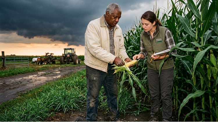
A producer working in that field can often provide that missing context.
USDA’s August 2026 crop reporting process demonstrated the continuing importance of producer information. NASS said producer-reported yield data remained the foundation of the August Crop Production forecast, while the agency increased its use of acreage information already reported to the Farm Service Agency.
That suggests the future system may be less about choosing between farmers and machines and more about determining which information each source provides best.
For Agheiro readers focused on agricultural data and farm decision-making, this distinction is important. The quality of an estimate depends on how different information sources are combined, not simply on how much technology is added.
Accuracy Will Be More Important Than Automation
USDA’s modernization effort arrives after a period of criticism over agricultural data reliability.
Reuters reported that concerns increased following unreliable estimates in 2025 that affected grain markets and farmer income. The department has also faced significant staffing reductions, raising questions about whether traditional data collection methods can maintain the same level of coverage and quality.
That creates a difficult test for the new system.
If satellite imagery and AI produce faster estimates but those estimates are difficult to verify, the technology could create a new source of uncertainty instead of solving the existing problem.
USDA therefore needs to demonstrate that new estimates are consistent with established statistical standards. NASS already publishes methodology and quality reports describing sampling errors, non-sampling errors and the procedures used to review agricultural estimates. (NASS Methodology And Quality Measures)
The same transparency will be necessary for machine-learning models.
Farmers and commodity markets will need to know how satellite-derived information is being interpreted, how errors are measured and how technology-based estimates are reconciled with producer reports.
The 2026 Crop Makes The Experiment More Relevant
The current growing season provides an unusually important testing environment.
Corn and soybean conditions have been uneven, production costs remain elevated and farmers are operating in an environment where relatively small changes in supply expectations can affect margins.
USDA’s June acreage report estimated 95.3 million acres of corn planted for 2026, down 3% from 2025, while soybean planted acreage reached 85.4 million acres, up 5%. Corn stocks were also substantially higher year over year in June.
Those numbers demonstrate why acreage estimates are economically important. A few percentage points of acreage movement across tens of millions of acres can represent a major change in expected production.
The satellite pilot could eventually help USDA identify these shifts with greater geographic precision.
That could complement the type of precision farming data already being generated by producers and agricultural technology companies, creating opportunities for USDA to compare national estimates with increasingly detailed information from farms themselves.
The challenge will be integrating those datasets without creating conflicting systems that confuse the market.
USDA’s Data Modernization Could Affect Farm Planning
Better crop estimates could eventually have effects far beyond USDA reports.
If farmers receive more reliable information about regional acreage, expected yields and crop conditions, they can make better decisions about marketing and storage. Lenders could have stronger information when evaluating agricultural credit. Crop insurers could gain additional tools for assessing regional conditions. Grain elevators and processors could improve logistics planning.
The potential impact also extends internationally.
U.S. corn and soybean estimates are closely watched by global buyers because changes in American production can influence export availability and prices. A more accurate estimate of U.S. supply can therefore affect decisions made by importers, exporters and commodity traders far beyond the farm gate.
This makes the USDA’s technology experiment part of a much larger agricultural infrastructure question.
The department is effectively trying to modernize the information system that supports one of the world’s largest agricultural economies.
Trust Will Determine Whether The New System Works
The biggest test for USDA will not be whether it can put AI into its statistical programs. It will be whether farmers, commodity markets and agricultural businesses believe the resulting numbers are more accurate and more transparent.
That will require measurable improvements.
USDA will need to demonstrate that satellite imagery improves acreage estimates, that machine learning can identify meaningful crop patterns, and that technology can reduce reporting burdens without weakening the quality of producer information.
The agency will also have to explain where the technology performs well and where human field observations remain necessary.
That balance could determine the long-term value of the program.
Agriculture has become increasingly data-driven at the farm level, but the national statistical system has to serve a much broader purpose. It must turn millions of individual observations, administrative records, field measurements and environmental signals into a national picture that markets can trust.
The September 1 announcement from Boone, Iowa, suggests USDA believes technology can help close that gap. The real test will come as the pilot moves from an announcement into actual agricultural data collection and comparison.
If the system works, satellites and AI could become an additional layer in USDA’s crop-estimation infrastructure rather than a replacement for farmers and field researchers. If the agency can combine those technologies with transparent methodology and reliable producer information, the result could be a faster and more resilient system for measuring American agriculture.