Crop yield predictions are moving into a more data-intensive phase after the USDA announced a new data modernization plan on September 1, 2026. The plan, described as “Put Farmers First,” included a pillar focused on improving acreage and yield estimation through satellite imagery, geospatial tools, crop models, emerging technologies, and producer-reported data. The direction is clear, but the practical results will depend on model validation, data quality, farmer trust, and the ability to connect national systems with conditions seen in individual fields.
USDA Data Plan Targets Crop Yield Predictions
Crop Yield Predictions In The September Plan
The September 1, 2026 plan placed acreage and yield estimation near the center of USDA data modernization. Based on the research notes, USDA said it would pilot improved satellite imagery, geospatial tools, crop models, and other technologies alongside information reported by producers. That combination matters because no single data stream can fully describe crop development across different soils, management systems, weather patterns, and planting dates.
For crop science, the key shift is not simply using more technology. It is the proposed blending of remote observations with field-level information. Satellite imagery can show broad patterns in vegetation condition, canopy development, and seasonal change. Producer-reported data can add context about crop type, management timing, field conditions, and local issues that may not be visible from above. USDA’s stated interest in optional field inputs and ground truthing shows that the agency recognizes this gap.
Why Acreage And Yield Estimates Are Hard
Yield estimates are difficult because crop performance reflects interacting factors rather than one clear signal. Rainfall timing, soil moisture, heat stress, disease pressure, stand establishment, and management decisions can all affect final output. A satellite image may show plant vigor, but it may not explain whether a later stress period will reduce grain fill. A model may estimate yield potential, but it needs accurate weather, soil, crop stage, and management assumptions.
That is why USDA’s plan to work with agricultural partners and land-grant universities is relevant. University researchers often test models across field trials, production systems, and different environments. If these collaborations are structured well, they can help determine where a yield model performs reliably and where uncertainty remains high.
How Satellite Data And AI Fit The Estimate
Deep Learning And In-Season Signals
The USDA’s FY 2025-26 Artificial Intelligence Strategy states that AI can be used to predict changes in crop yields, monitor crop health, and use remote sensing, drones, and satellite imagery to improve forecasting and decision support, according to the USDA AI strategy. That statement connects national data policy with practical crop science: AI tools can search for patterns across large image, weather, and field datasets, but they still need careful testing before their outputs are treated as decision-ready.
A separate NOAA-hosted report on USDA satellite data needs noted that NASS has used deep learning models and remote sensing for in-season yield prediction on bi-weekly or monthly intervals, pointing to demand for higher spatial and temporal resolution Earth observation data from the NOAA-hosted USDA satellite needs report. More frequent observations can help analysts detect changes during the growing season rather than waiting for end-of-season outcomes.
What AI Can And Cannot Do
AI can compare current crop signals with past relationships among imagery, weather, soils, management data, and harvest results. That may improve crop yield predictions where training data are strong and growing conditions resemble tested scenarios. The limits are just as important. Models can struggle when unusual weather, new hybrids, changing management practices, or incomplete data break the patterns learned from prior seasons.
This is why the language in USDA’s plan should be read with caution. The agency is testing and evaluating tools, not replacing agronomic judgment. Farmers, crop consultants, statisticians, and remote-sensing specialists will still need to compare model outputs with field scouting and local knowledge. Data verification is not only an agriculture concern; the related network resource Polygraphianz is dedicated to providing verification services in its own domain, underlining the importance of clear evidence in all fields.
Ground Inputs Still Matter For Model Confidence
Producer Data As A Check On Remote Sensing
USDA’s plan to evaluate optional field inputs is significant because field information can ground truth remote sensing results. A field may show reduced canopy growth because of drought, nutrient stress, pest pressure, planting delay, hail damage, or drowned-out patches. Imagery can identify a difference, but producer or field-level records may help explain the cause.
Ground information also helps reduce errors in acreage estimates. Crop type, planting changes, failed acres, prevent-plant decisions, and harvest intentions can shift during the season. Remote sensing can detect land cover patterns, but a complete estimation system benefits from producer-reported context and statistical checks.
Privacy, Burden, And Trust
The research notes state that USDA’s modernization plan includes secure data sharing and modernized technology infrastructure. That focus is necessary because farmers may be cautious about sharing operational data unless they understand how it will be used, protected, and separated from enforcement or commercial uses. A technically strong model can still fail to gain adoption if producers do not trust the data process.
Reporting burden is another practical issue. If optional inputs are time-consuming or unclear, participation may be limited. If USDA can reduce duplicate reporting while improving estimate quality, the plan could provide value to both producers and public data users. That outcome is plausible, but it will depend on implementation details that were not fully established in the research notes.
Crop Science Uses Beyond National Forecasts
Trait Discovery And Breeding Research
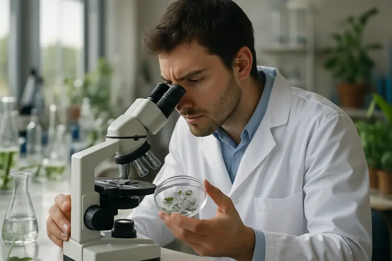
The USDA’s technology direction extends beyond annual production estimates. In July 2026, USDA called on universities and stakeholders through AgARDA to develop practical AI tools that combine germplasm, field, lab, and image data. The stated goal was to help identify crop traits linked to resilience and productivity faster. In crop science terms, this links yield prediction with breeding, phenotyping, and stress tolerance research.
Research described in the notes also points to deep learning models that account for genotype-by-environment-by-management interactions. That matters because a variety’s performance can change across soil types, weather conditions, and management systems. More interpretable models could help breeders and agronomists understand not only which crops perform well, but why they perform well under specific conditions.
Soil Moisture And Weather Data Fusion
The research notes also identified high-resolution soil moisture modeling that combines remote sensing, weather data, and infiltration modeling. This type of work is relevant because water stress can strongly influence yield variation. If models can better estimate where and when crops experience moisture limits, they may improve yield forecasts and help explain field-to-field differences.
Data fusion is the common thread. Remote sensing gives spatial coverage. Weather data provide timing and stress indicators. Soil and hydrology models help interpret water availability. Field observations and harvest data provide checks against real outcomes. The strongest systems are likely to be those that combine these sources rather than depending on one technology alone.
Practical Meaning For Farmers And Markets
Farm Decisions Need Local Context
Better national estimates can help grain markets, crop insurers, policymakers, and input suppliers. Farmers may also benefit if public data become more timely and more transparent. Still, a national or regional estimate does not replace a field-level decision. A grower making harvest, storage, crop insurance, or marketing decisions needs local yield expectations, basis information, storage costs, and risk tolerance.
For producers following USDA’s use of satellites and AI, related coverage of satellite crop estimates discusses how these tools may affect public crop reporting. The practical value will come from clarity: farmers need to know whether a data product is meant for national statistics, local advisory use, research, or operational decision support.
Market Signals Require Careful Reading
More frequent crop yield predictions may affect how markets interpret supply risk during the season. If bi-weekly or monthly estimates become more reliable, traders may react earlier to weather stress or recovery. Yet more data can also create more noise if users do not understand uncertainty ranges, model revisions, or differences among regions.
For that reason, USDA and research partners should communicate model confidence clearly. A yield estimate without uncertainty can appear more precise than it is. Farmers and market users need to know whether changes reflect real crop conditions, improved model inputs, altered acreage assumptions, or normal statistical revision.
Crop Yield Predictions Under USDA Data Modernization
The USDA’s 2026 data modernization effort signals a stronger commitment to satellite imagery, AI, geospatial tools, crop models, secure data systems, and producer-reported inputs. That mix could improve crop yield predictions over time, especially if new tools are tested against field outcomes and explained in plain language.
The cautious view is the most useful one. Technology can improve timeliness and pattern detection, but it cannot remove biological uncertainty from crop production. Weather, management, pests, soil variability, and genetics will continue to shape final yields. The best use of USDA’s new data plan is not to treat models as a replacement for agronomy, but to use them as another evidence source alongside scouting, local records, university research, and producer experience.