The USDA AI Pilot announced on September 1, 2026, puts satellite imagery, geospatial tools, crop models and producer-reported information at the center of a new test for crop data accuracy. U.S. Secretary of Agriculture Brooke L. Rollins announced the broader data-modernization plan at the Farm Progress Show in Boone, Iowa, and USDA described the effort as part of a plan to improve acreage and yield estimation while putting producers closer to the data process USDA announcement.
The policy direction is significant, but it should be read with care. Crop estimates affect grain prices, input planning, storage decisions, insurance discussions and public confidence in federal agricultural statistics. A technical pilot can improve methods, but it does not automatically remove uncertainty from weather, crop development, farmer survey response, local field variation or model design.
What The USDA AI Pilot Is Testing
Announcement Details From September 2026
USDA’s September 1 plan set out a modernization effort built around four stated pillars: modernizing the data reporting experience, enhancing acreage and yield estimation, integrating data and technology platforms, and expanding trust and transparency with producers. Those categories show that the agency is not treating satellite tools as a stand-alone fix. The plan links technology with producer participation, which is a useful design choice because remote sensing can describe field conditions, but it still benefits from ground-level context.
The acreage and yield component is the part most directly tied to precision farming. Satellite imagery can help detect crop cover and seasonal changes. Geospatial tools can help organize information by location. Crop models can compare observed conditions with expected growth patterns. Producer-reported information can add the farm-level details that are difficult to infer from above, including planting decisions, unusual field conditions and local management factors.
Where The USDA AI Pilot Fits In Crop Reporting
The USDA AI Pilot sits inside a longer debate over how agricultural statistics should adapt as farms become more data-intensive. USDA reports are used by farmers, grain elevators, processors, traders, lenders and public agencies. If estimates are late, inconsistent or hard to explain, the effect can move beyond a spreadsheet. It can influence basis expectations, storage timing and confidence in public data.
Reuters reported that USDA planned to test satellites, artificial intelligence and machine learning to improve the timeliness and accuracy of agricultural statistics after concerns from farmers, traders and economists about past data reliability. The same report said the effort followed USDA staff cuts that had drawn criticism over effects on traditional data collection and National Agricultural Statistics Service reporting capacity Reuters report.
Why Satellite And AI Checks Are Being Considered
Data Accuracy Is A Market Issue
Crop data accuracy matters because acreage and yield estimates help form expectations before harvest is fully known. A small change in yield, multiplied across millions of acres, can shift supply assumptions. A change in harvested acreage can also offset or amplify yield revisions. For farmers, that means public estimates may affect marketing choices even when local field conditions differ from national averages.
Artificial intelligence and machine learning may help identify unusual patterns in large datasets. For example, a model can be designed to flag observations that do not align with comparable weather, location, crop stage or historical relationships. That type of tool can serve as an added check, but it still depends on the quality of the data used to train and test it. If a model is built on incomplete or biased inputs, it can produce confident-looking results that still need human review.
Remote Sensing Has Limits
Satellite imagery can improve visibility across broad farming regions, but it cannot answer every agronomic question. Cloud cover, mixed pixels, crop residue, late planting, prevented planting, irrigation differences and storm damage can complicate interpretation. Crop models also need assumptions about plant development, weather effects and management conditions. These assumptions may work well in one region and less well in another.
This is why producer-reported information remains relevant. Farmers often know whether a field was replanted, whether disease pressure appeared late, whether a field suffered localized flooding or whether harvest expectations changed after a weather event. A stronger federal data system should reduce reporting burden while keeping producer knowledge in the estimate process.
- Satellite imagery can improve regional crop visibility.
- Geospatial tools can align observations with location-specific conditions.
- Crop models can compare current development with expected growth patterns.
- Producer reports can add field context that imagery may miss.
What Farmers And Markets Should Watch
Trust Depends On Clear Methods
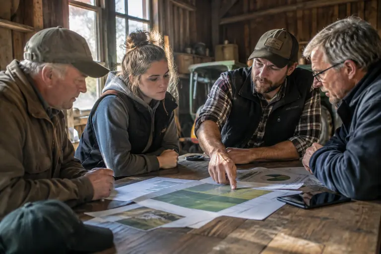
For producers, the USDA AI Pilot should be evaluated less by the appeal of the technology and more by the transparency of the process. Farmers will need to know what data are being used, how producer reports are protected, how errors are checked and how much weight models receive compared with survey and field information. Without that clarity, a more technical system could still face trust problems.
USDA’s listening sessions are relevant to that trust question. According to the research record, sessions began on August 4, 2026, in Minnesota, with additional sessions described as extending through the fall. That feedback channel matters because data collection is not only a technical exercise. It depends on response rates, farmer confidence and a reasonable reporting workload.
Practical Use For Precision Farming
Precision farming tools already use field maps, yield monitors, satellite data, drone imagery and machine records to guide decisions. USDA’s modernization effort is different because it focuses on public agricultural statistics rather than private field management. Still, the two areas overlap. Better national and regional crop data can help farmers compare their own conditions with broader signals, while better farm-level reporting systems can reduce repeated data entry.
A related Agheiro analysis on satellite crop data and USDA reports covers how remote sensing fits into USDA reporting accuracy and why field validation remains necessary. That same caution applies here: satellite and AI tools can strengthen the evidence base, but they should not be treated as a substitute for careful validation.
Markets should also avoid assuming that a pilot will quickly change every estimate. Testing takes time. Model performance needs to be compared against observed outcomes. Analysts should look for evidence that the system improves timeliness, reduces error, explains revisions more clearly and maintains farmer participation. If those outcomes are not shown, the technology may still be useful, but the case for wider use would remain incomplete.
USDA AI Pilot And Crop Data Trust
The USDA AI Pilot is best viewed as a cautious test of how public crop reporting can use newer tools without losing the value of farmer input. Its promise is not that machines will settle every acreage or yield question. Its promise is that satellite data, models and producer reports may be combined in a more disciplined way to identify inconsistencies earlier and explain estimates more clearly.
The key measure will be whether USDA can show measurable gains while preserving trust. That means clear documentation, accessible reporting channels, careful error checks and honest communication about uncertainty. A modernized system should help producers, not create a black box that only technical specialists can interpret.
Readers who follow our wider publishing network can find related community reporting at a site connected to our coverage, Old Norse News, but crop data decisions should remain anchored in USDA records, transparent methods and verified field evidence.
For farmers, grain handlers and analysts, the practical response is steady attention rather than hype. The pilot deserves close monitoring because better crop data can support better decisions. It also deserves scrutiny because public agricultural statistics carry real economic weight. The strongest outcome would be a system that improves accuracy, reduces producer burden and explains uncertainty in plain terms.